Should Laser Scanning be regulated?
)
By Jeffrey Gutierrez | May 19, 2014 | 3D Services, Blog, General
Should Laser Scanning be regulated by the State Board for Professional Engineers & Land Surveyors?
Over the past few years the emerging technology known as 3D Laser Scanning has become available to the masses and is being utilized by a variety of different industries, such as architectural, oil & gas, industrial food processing, historical societies, transportation and structural… just to name a few.
As this technology has been becoming more prevalent in the day to day work flow of mechanical engineers, architects, structural and civil engineers, the question has been asked… “just who is providing this data?” Well, just who is providing this data? If you look back through the history of these previously mentioned industries, you see one common thread as to the primary source of all of the as-built data that these industries have relied upon for the “starting point” of all of the design work… the Licensed Land Surveyor.
The land surveyor has been relied upon for his training and expertise in the area of establishing horizontal locations and vertical elevations of fixed features upon the surface of the earth. The Professional Land Surveyors Act defines the practice of Land Surveying in part as “(a) Locates, relocates, establishes, reestablishes, or retraces the alignment or elevation for any of the fixed works embraced within the practice of civil engineering… (b) Determines the configuration or contour of the earth’s surface, or the position of fixed objects above, on, or below the surface of the earth by applying the principles of mathematics or photogrammetry.” According to these two paragraphs, one could begin making a case for the fact that a 3D Laser Scanner is simply another tool that is being used to acquire the necessary data to provide the items listed in paragraphs (a) & (b) above?
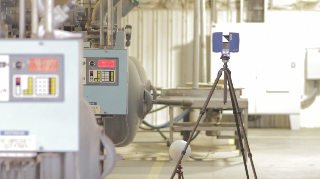
Let’s take a quick broad look at exactly what the Laser Scanner does to capture its data. The 3D Laser Scanner utilizes a beam of light to “measure” millions of data points on any object within its line of sight, whether existing pipelines, tanks, buildings, parking structures, structural steel, finished or natural ground to create topography, or any other fixed object on the surface of the earth, of which your desire is to capture an accurate “as-built”. This data that is captured by the Laser Scanner is basically the same data that Land Surveyors have been capturing for decades, the Laser Scanner simply captures a great deal more data and at a much greater density than a land surveyor has ever been able to capture with traditional methods of surveying… it is this surveyor’s opinion that this fact lends a great deal of support for the argument that the Laser Scanner is simply an incredible piece of new technology that belongs in the toolbox of the Professional Land Surveyor.
…Laser Scanning is simply an incredible piece of new technology that belongs in the toolbox of the Professional Land Surveyor.